

The future of London’s tube map is a little bit stressful.
London is growing at a serious clip. After forty years of population decline finally ended in 1991 – when it reached a low of 6.1 million – a period of massive urban renewal has seen our city grow to a record high of 8.9 million Londoners in 2019 – and it shows no sign of slowing down.
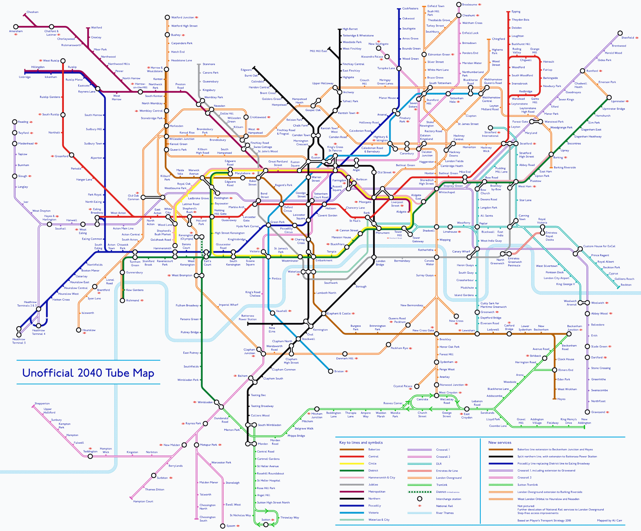
With 17% of all Brits living in the city, we’re going to need more ways of getting around. The Elizabeth Line be delayed until 2022 the end of time, but this unofficial tube map, created by designer Ali Carr, shows what plans transport chiefs have in the long term.
(Click here to see the full-size map.)
In south-east London, the Bakerloo line will extend along the Old Kent Road to New Cross, Lewisham, and onto Catford, Hayes and Beckenham Junction; meanwhile, the Elizabeth Line (nee Crossrail) will extend past Abbey Wood as far as Dartford and Gravesend. CONNECTIONS!

In north-east London, Crossrail 2 will forge new connections between Dalston, Seven Sisters and Alexandra Palace and head as far north as Broxbourne, while the tangle of London Overground services will glow as orange as ever.
Meanwhile, in Central London, the tube map is becoming slightly bewildering. Euston Square, Euston, Kings Cross and St. Pancras merge into an enormous transit hub in this diagram, even they’re almost a kilometre apart.

Other changes to spot: an extension of the south London tram service to Sutton; the Crossrail 2 service reaching as far south as Epsom and Shepperton; the controversial division of the Northern Line into two separate lines (breaking up is hard to do!) and the spur for Battersea Power Station; plus all-new London Overground services in West London. Exciting times!