

This super-cute map is filled with gorgeous illustrations and fun facts about London’s history and culture.
Cally Lathey, as in House of Cally, works pure magic with her fineliner pens. And she’s struck again with another illustrated map of London – only this time it’s educational.

As you study the incredibly detailed map, you’ll discover many London-related facts written beside relevant illustrations. It features iconic landmarks, hidden places and famous faces from the past and present.
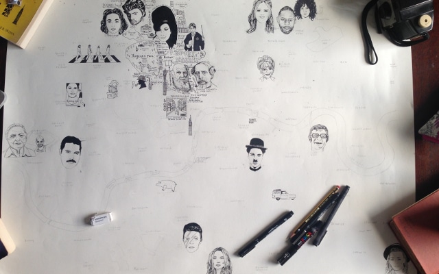
The map was lovingly hand-drawn over a period of 11 months, but it wasn’t all about the art. Cally says, “the research process for this map was very intense and laborious. I read extensively, scoured online articles, listened to London-related podcasts and music, watched many London films, trekked around searching for blue plaques and new bits of trivia and then had to cross check all of the information and dates.”

Drawing inspiration from her favourite places in the city, as well as her favourite London bands and artists, the finished product is truly mesmerising. You could look at it 1,000 times and always notice something new.

Did you know that Cher used to live in Wapping? Or that Karl Marx used to live on Soho’s Dean Street? Or that UK Garage began inside an Elephant & Castle pub? These are exactly the kind of fun facts you’ll discover as you admire Cally’s map.

There are also references to famous Londoners throughout, as well as a few nods to brilliant boozers, green spaces and even legendary pie and mash shops.

In a blog post about her work, she finishes by saying, “I have learnt so much about the city that I have spent my entire life in and thought I knew so well.”